Science and Technology Research Partnership
for Sustainable Development
Font size
- A
- A
- A


Research and Development for Reducing Geo-Hazard Damage in Malaysia Caused by Landslide and Flood
Disaster Prevention and Mitigation
 Malaysia
Research and Development for Reducing Geo-Hazard Damage in Malaysia Caused by Landslide and Flood
Predict, warn and reduce the risk and damage of floods/ inundations and landslides through recent technologiesg
Principal Investigator
-

Prof.
Graduate School of Engineering, The University of Tokyo
TOSAKA Hiroyuki
ODA Recipient Country
Malaysia
Research Institutions in Japan
The University of Tokyo / Chiba University / National Research Institute for Earth Science and Disaster Prevention (NIED) / Public Works Reserch Institiute (PWRI)
Research Institutions in Counterpart Country
Malaysia Multimedia University (MMU) / University of Science, Malaysia (USM) / Tenaga Nasional University (UNITEN)
Adoption fiscal year
FY 2010
Research Period
5 Years
Overview of the Research Project
Heavy rainfalls in monsoon season cause serious floods/inundations and landslides in Malaysia
In Malaysia on Malay Peninsula, heavy rainfalls in monsoon season have frequently brought about flood/inundations and landslides. The rapid urbanization taking place in disaster prone areas in which actual countermeasures are none or not effective have been boosting the amount of damages. In this project, Malaysia-Japan organizations/researchers have been working cooperatively for realizing significant reduction of casualties and property damages by flood/inundations and landslide. We introduce and use recent technologies in the study, such as remote sensing (satellite and aircraft) and its analysis technologies, latest field monitoring technologies, up-to-date numerical simulation technologies and social communication software system. It is expected that the acievements in this project will be applicable not only for Malaysia, but for other south-east Asian countries for reducing water-related disasters.
Integration of data and proposal of EWS
Through the study, we will make up an integrated data base, install flood/inundation prediction software, prepare hazard maps for inundation prone areas, wide ranged risk maps of landslide, and propose EWS (Early Warning System) for quick and safe evacuation of local residents.
Photo gallery
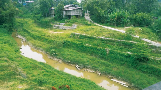
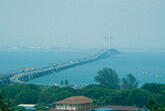
Middle reaches of Kelantan River: During flooding, water level rises to the floors of houses. Inundations take place in many areas along the Kelantan downstream.
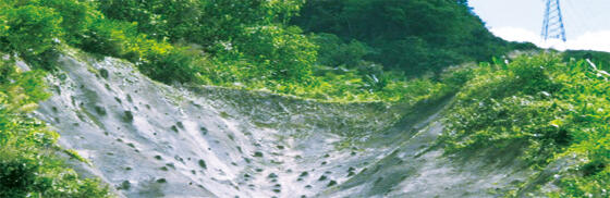
Collapse of base of power line tower: Slope failures occur frequently, causing damages to social infrastructure, such as road blockages, collapse of power line towers. Extending urbanization may increase risk in residential areas.
Research Project Web site
Press Release
Links
Projects
Contact Us
Japan Science and Technology Agency (JST)
Department of International Affairs
SATREPS Group
TEL : +81-3-5214-8085


Related articles by Category
- Disaster Prevention and Mitigation
Disaster Prevention and Mitigation

 Kingdom of Tonga
Volcanic island nations working together to reduce the risk of eruption and tsunami disasters!
Disaster Risk Reduction of Widespread Volcanic Hazards in Southwest Pacific Countries
- Malaysia
Environment / Energy
(Global-scale environmental issues)
- Malaysia
Recover water, electric power, and mineral resources from palm oil mill effluent!
Development of Palm Oil Mill Effluent (POME) Treatment System for Sustainable Energy Production and Resource Recovery based on Material Innovation
- Asia
Environment / Energy
(Global-scale environmental issues)
 Kingdom of Thailand
“Natural rubber seeds”, the unlimited potential hiding in natural rubber plantations
Utilization Technology of Rubber Seeds for Green Products to Mitigate Global Warming and Plastic Pollution
- SDGs : Goal.11
Disaster Prevention and Mitigation
 Republic of El Salvador
Protecting international port cities from compound disasters with dominostyle chains of destruction!
Compound Disaster Risk Reduction associated with Large Earthquakes and Tsunamis