Science and Technology Research Partnership
for Sustainable Development
Font size
- A
- A
- A


Preventing tsunami damage by developing a seafloor monitoring network off the Mexican coast and providing disaster prevention education
Preventing tsunami damage by developing a seafloor monitoring network off the Mexican coast and providing disaster prevention education
Research Fields and Areas
Disaster Prevention and Mitigation
What is the background of the study?
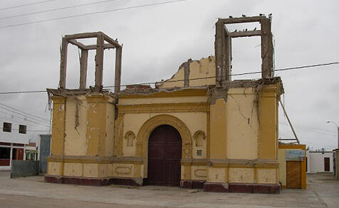
Like Japan, Mexico is known to be an earthquake-prone country. The Pacific coast of Mexico is located in a subduction zone, and has suffered from tsunami damage due to major earthquakes on numerous occasions during the past 250 years. The northern coast of Guerrero State, however, has not experienced an earthquake for the last 100 years. The reason is known to be the repeated occurrence of slow slip events at intervals of several years, so that some of the interplate deformation is released without earthquake movement. However, it has been shown that not all this deformation is in fact released, and as it gradually builds up, it is likely to cause a massive earthquake in the near future
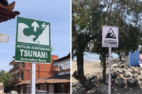
Although Mexico would like to evaluate the possibility of future massive earthquakes, its earthquake monitoring mainly consists of geodetic observations on land, and it has not previously conducted seafloor monitoring. The country's tsunami preparedness and countermeasures are also inadequate.
This project therefore addressed the Guerrero seismic gap, with the goals of assessing the size of the potential future massive earthquake, and developing a disaster scenario for this massive earthquake and tsunami and a disaster-mitigation education program.

Who is the Principal Investigator?
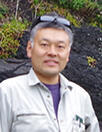

Associate Prof. ITO Yoshihiro
Disaster Prevention Research Institute, Kyoto University


Dr. Victor Manuel Cruz Atienza
Instituto de Geofísica, Universidad Nacional Autónoma de México (UNAM)
What have they achieved?
1
They have introduced seafloor monitoring technology to Mexico, and developed a seafloor monitoring network!
Earthquake monitoring in Mexico mainly consisted of geodetic observations on land, but in a joint project with partners including the Universidad Nacional Autónoma de Mexico, they introduced the Global Navigation Satellite System (GNSS) on land and on the seafloor to the Guerrero seismic gap in the state of Guerrero on Mexico's Pacific coast, and created an earthquake monitoring network.
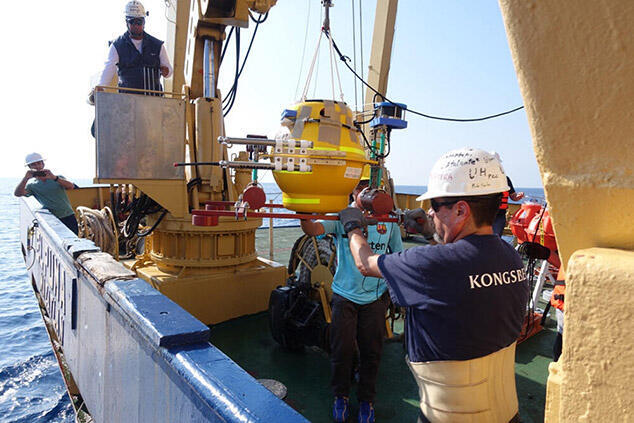
Placing seafloor monitoring equipment on the sea bed

2
They made new discoveries about interplate coupling in the interaction between slow slip and massive earthquakes!
They analyzed the data obtained from the earthquake monitoring network on land and on the seafloor, and investigated the association between the three major earthquakes that occurred in Mexico between 2017 and 2019 and slow slip. Slow slip is a phenomenon in which the distortion is released at a much lower fault slip rate than that of regular earthquakes. In this seismic gap, the coupling between the plates is much weaker than it is in surrounding areas, which means that because the adhesion at the boundary between the plates is weak, one plate is sinking smoothly under the other without distortion building up, and slower earthquakes are occurring.
This project was also the first to detect the occurrence of a slow earthquake in the Guerrero seismic gap. This showed that the absence of a major earthquake in the Guerrero seismic gap for almost the last 100 years was due to the release of the distortion by slow earthquakes, and does not mean that a century's-worth of distortion has built up.
Although the distortion is being released, slow earthquakes can also be the cause of major earthquakes, and continued measures to limit earthquake and tsunami damage are still needed.
3
They created and validated a hazard risk map, and set up a disaster-mitigation education program!
Based on the most recent monitoring data for the Guerrero seismic gap, they created an earthquake/tsunami scenario. They also set up a disaster-mitigation education program building on the foundation of the region's social, economic, and cultural background, and made people throughout the region aware of everyday preparations in collaboration with the local disaster prevention bureau.
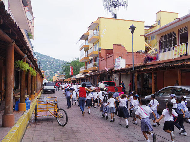
Children taking part in a tsunami evacuation drill
What happens next?
The outcomes of this project were well received in Mexico, and their use is expected to continue in future. Efforts are now getting underway to extend the tsunami disaster-mitigation education program to other areas of Mexico and to other countries in Central and South America and the Caribbean. The project ended in 2022, but joint research will still continue in future.
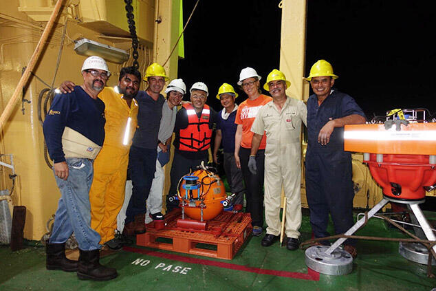
Preparing the monitoring equipment on board ship

Disaster Prevention and Mitigation
Mexican
Case Studies
Contact Us
Japan Science and Technology Agency (JST)
Department of International Affairs
SATREPS Group
TEL : +81-3-5214-8085


Related articles
-
Disaster Prevention and Mitigation
 Republic of Peru
Earthquake and Tsunami Disaster Mitigation - Global benefits from Japan-Peru research -
-
Disaster Prevention and Mitigation
 Republic of Cameroon
Investigating the silent seeds of disaster in two lakes
- Saving lives from disasters caused by CO2 - -
Environment / Energy
(Global-scale environmental issues)
 Arab Republic of Egypt
Water conservation in the Nile basin
- Saving water provides resources to turn desert into farmland - -
Environment / Energy
(Global-scale environmental issues)
 Republic of Zambia
Helping to identify mechanisms of lead pollution in Zambia, and proposing effective antipollution measures.