Progress Report
Control Theory of Weather-Society Coupling Systems for Supporting Social Decision-Making[A-3] Exploring technologies to modify moist-convection over ocean
Progress until FY2024
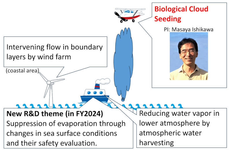
1. Outline of the project
- Background:
- When attempting to appropriately intervene in severe weather to mitigate its threats, it is critically important to consider what kind of intervention methods should be used. Phenomena that develop over the ocean, like tropical cyclones, ideally should be intervened over ocean. It is necessary to develop new intervention methods that do not currently exist, in collaboration with theoretical research.
- Objective:
- Based on the other theoretical R&D Item, we will develop novel and realistic intervention methods which can significantly alter the future of extreme weather events, including tropical cyclones.
- Method:
- We will focus on the individual cumulonimbus clouds which are generated in tropical cyclones over ocean. By taking a multifaceted approach to these cumulonimbus clouds and the moist convection which produces them, we aim to suppress these clouds (see Fig. 1). We will explore methods that can be implemented over ocean.
2. Outcome so far
- ① This R&D Item was launched in January 2024. In collaboration with other R&D Items, as shown in Fig. 1, we have formulated a strategy to intervene the weather systems which produce individual cumulonimbus clouds over ocean from both the top and bottom of the atmosphere.
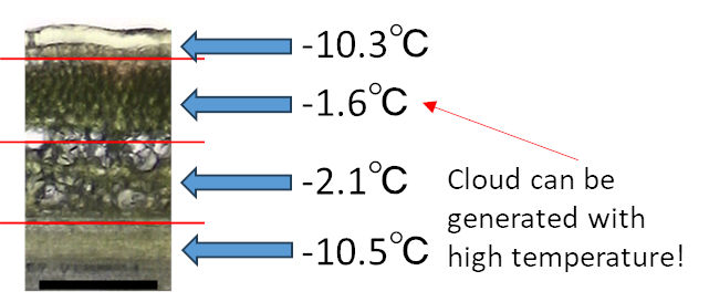
- ② To realize the effective intervention from the top of the atmosphere, we are exploring ice-nucleating substances derived from plants and fungi. In the atmosphere, water may not freeze—even at temperatures as low as -30°C—if there are no particles to act as ice nuclei. As a result, clouds may not form. By dispersing these substances from aircrafts and other means, we aim to control weather which produces cumulonimbus clouds. Compared to similar approaches, our goal is to design solutions which have minimal environmental impacts and are more effective. Fig. 2 summarizes the ice-nucleating activity inside blueberry branches. It has been found that ice can form inside blueberry branches even at relatively high temperatures (e.g., -1.6°C), which typically do not support ice formation. In fiscal year 2024, we studied ice-nucleating substances found in forsythia branches and similar materials. We found that they have ice-nucleating activity comparable to silver iodide, which is commonly used in cloud seeding. At the same time, we also studied fungi and other organisms collected from under the snow.
3. Future plans
Although this R&D Item has only been running for just over a year, we have successfully started work on a new approach that focuses on the top of cumulonimbus clouds and have already seen some early results. We will continue to look for new substances that can efficiently create clouds and ice in the atmosphere.
We are also working more closely with R&D Item A-2. Together, we are using simulations to examine how much these new substances can affect cumulonimbus clouds over the ocean. If the simulations show good results, the next challenge will be to find a way to produce these substances in large amounts.
In addition, theoretical studies in other R&D Items suggest that changing the humidity in the bottom of the atmosphere could be a promising method. So, we plan to develop and test ways to do this in our project.