Science and Technology Research Partnership
for Sustainable Development
Font size
- A
- A
- A


Project for Enhancement of Earthquake and Tsunami Disaster Mitigation Technology in Peru
Disaster Prevention and Mitigation
 Republic of Peru
Project for Enhancement of Earthquake and Tsunami Disaster Mitigation Technology in Peru
Standing Up to Earthquakes and Tsunamis: Joining Hands with Peru across the Pacific
Principal Investigator
-


Prof.
Graduate School of Engineering, Chiba University
YAMAZAKI Fumio
ODA Recipient Country
Republic of Peru
Research Institutions in Japan
Chiba University / Tohoku University / Toyohashi University of Technology / Tokyo Institute of Technology
Research Institutions in Counterpart Country
Japan-Peru Center for Earthquake Engineering Research and Disaster Mitigation (CISMID) of National University of Engineering (UNI)
Adoption fiscal year
FY 2009
Research Period
5 Years
Overview of the Research Project
Support that only another earthquake-prone nation can provide
Like Japan, Peru is located in the circum-Pacific seismic zone and subject to frequent earthquakes and tsunamis. The 2007 earthquake and tsunami caused major damage. Efforts are underway to study and develop effective technologies for evaluating the risk of disasters caused by future earthquakes and tsunamis and mitigating the damage caused by these disasters. In this project, researchers will develop seismic source models based on past major earthquakes, conduct tsunami simulations, study building earthquake-resistance, develop retrofitting technologies and so on. An effort will also be made to promote comprehensive earthquake and tsunami damage prediction and disaster mitigation technologies that take into account regional attributes.
Determination of regional attributes and establishment of effective disaster mitigation plans for earthquakes in Peru
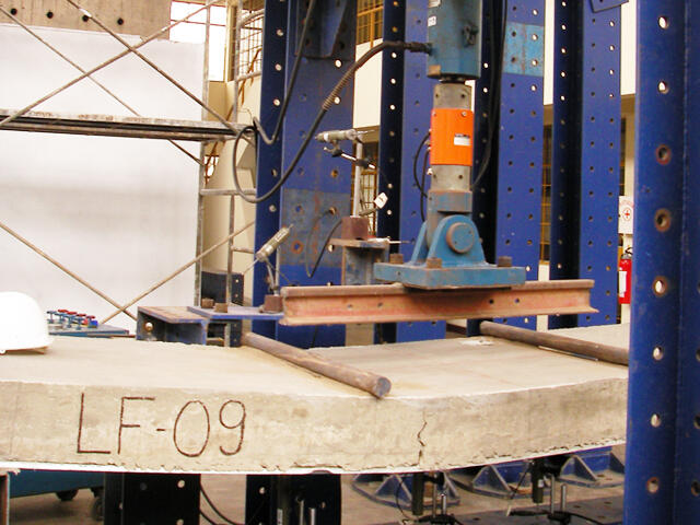
Model case studies of major earthquakes that have occurred in the past will be selected to predict earthquake motions resulting from plate boundary earthquakes off the coast of Peru and promote tsunami damage assessment. Study of the earthquake resistance of buildings including historical structures is progressing smoothly, and satellite images have been used to prepare land use maps. These results will be integrated to establish effective disaster mitigation plans that are appropriate for the region.
Photo gallery

Church in the center of Pisco City that collapsed in the 2007 earthquake
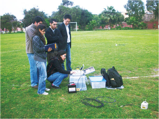
Observations of microtremors in Lima, using equipment provided in this project. This makes it possible to assess ground shaking in the event of an earthquake.
Research Project Web site
Press Release
Links
Projects
Contact Us
Japan Science and Technology Agency (JST)
Department of International Affairs
SATREPS Group
TEL : +81-3-5214-8085


Related articles by Category
- Disaster Prevention and Mitigation
Disaster Prevention and Mitigation
 Republic of Turkey
Use disaster mitigation science to reduce the damage from massive active-fault earthquakes!
Establishment of a Research and Education Complex for Developing Disaster-resilient Societies - MARTEST
- Peru
Bioresources
- Republic of Peru
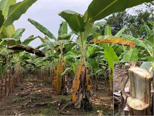
Stop the invasion and spread of banana wilt from threatening the banana industry!
Establishment of an Alert System for Fusarium oxysporum f. sp. cubense, the Banana and Plantain Wilt Pathogen, and Mitigation Strategy of the Disease
- Latin America
Bioresources
 Republic of Chile
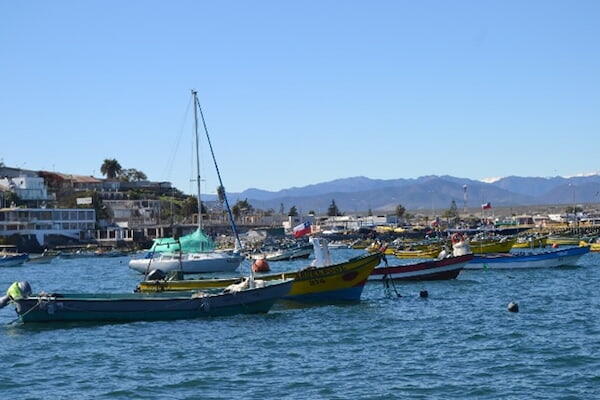
Create a new industry by effectively recovering bioproducts from fisheries waste!
Recovering High-Value Bioproducts for Sustainable Fisheries in Chile (ReBiS)
- SDGs : Goal.11
Disaster Prevention and Mitigation
 Malaysia
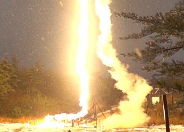
Mitigating the damage caused by 200 lightning days a year by nowcasting with advanced observation network
Real-Time Lightning 3D Imaging and Forecasting Project for Sustainable and Reliable Supply of Energy and Storm Disaster Early Warning